One of the things I love about Lake Tahoe is the beautiful views and how many hiking trails there are to explore and enjoy! There are Lake Tahoe hikes for everyone from relaxing strolls or epic day trips, no matter your experience or fitness level. I’ve put together a guide for everything you need to enjoy a day of hiking, as well as the 5 of the Most Beautiful Lake Tahoe Hikes!

Lake Tahoe Hikes
What Do I Need to Enjoy the Best Lake Tahoe Hiking Trails?
Before you start any hike, make sure you check the local weather conditions where you are hiking. Next, make sure you’ve packed the hiking ten essentials.
Packing the “Ten Essentials” whenever you step into the backcountry, even on day hikes, is a good habit. True, on a routine trip, you may use only a few of them or none at all. It’s when something goes awry that you’ll truly appreciate the value of carrying these items that could be essential to your survival.
The original Ten Essentials list was assembled in the 1930s by The Mountaineers, a Seattle-based organization for climbers and outdoor adventurers, to help people be prepared for emergencies in the outdoors. Back then, the list included a map, compass, sunglasses and sunscreen, extra clothing, headlamp/flashlight, first-aid supplies, fire starter, matches, knife, and extra food.
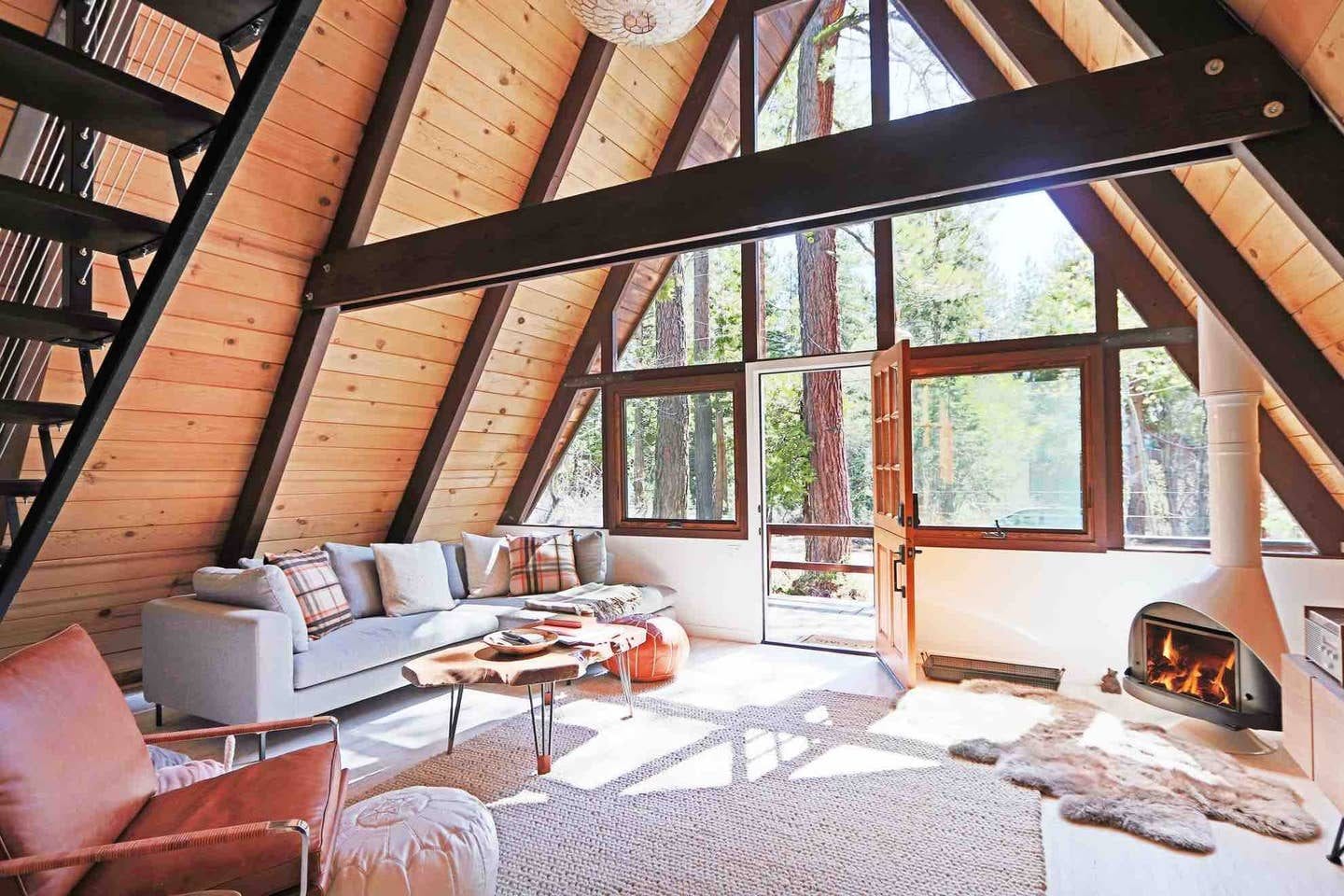
You’ll also want to find a place to stay in between your hiking excursions. Check out The Tahoe A-Frame.
A cozy Tahoe A-frame nestled in Homewood, CA. We recently completed a full renovation of this 1963 original A-Frame cabin on the very desirable West Shore in Lake Tahoe. Check out our VIDEO TOUR of the cabin on our Instagram: @TheTahoeAFrame.

Here are just a few amazing hikes you can plan for your trip to Lake Tahoe. For more information or for more trails that you can explorer visit laketahoe.com.
Mount Tallac (9.5 mi round trip) – South Lake Tahoe
The hike to the top of Mount Tallac near Emerald Bay is one of the more difficult hikes in the area, and, from the number of photos and commentaries, also one of the most rewarding. From the top of this 9.5-mile round trip hike, you can see Emerald Bay, Cascade Lake, Fallen Leaf Lake, Desolation Wilderness, and the entire South Shore of Lake Tahoe. The elevation gain is 3,500 feet, so be prepared for some terrain change from the forest and alpine lakes at the bottom to scree and boulders at the top.
Directions: The Mount Tallac trailhead is located on Highway 89 between Camp Richardson and Emerald Bay. Take the Mount Tallac Road to the trailhead.
Echo Lakes to Ralston Lake (6 mi round trip) – South Lake Tahoe
This trail is another way to access Desolation Wilderness, but if you want to keep it simple, just stick to the first part with its low elevation gain. From the Echo Chalet on Lower Echo Lake, you can either start hiking on the trail that heads into Desolation, or take a water taxi across Lower Echo Lake to get a head start on the trail. The trail has some beautiful views of the mountains in Desolation and access to the cool, beautiful alpine lakes of Tamarack and Ralston.
Directions: The trailhead is located on Highway 50 at Echo Summit. Turn onto Johnson Pass Road. Stay left and the road will lead you to the parking area by Lower Echo Lake.
Eagle Falls & Eagle Lake Trail (2 mi round trip) – South Lake Tahoe
If you are in the Emerald Bay area, take the steep switchback trail from the Vikingsholm Castle up to the Vikingsholm parking lot. Follow the road to the entrance of Desolation Wilderness and the Eagle Falls Trailhead. This is a very popular hiking and parking area in the summer, so get there early. The trail up to Eagle Lake is only one mile up, but the initial part of the trail is steep and rocky. However, about halfway up, you will get some stunning views of Emerald Bay. Eagle Lake itself is really beautiful, and this trail will give you access to additional hiking in the Desolation area.
Directions: From South Lake Tahoe drive West on Highway 89 towards Emerald Bay. At the overlook for Emerald Bay, look for the signs for the Eagle Falls trailhead/Desolation Wilderness parking area. The parking fills up quickly in the summer and fall, so get there early. You will be ticketed if you park on the side of the road.
Tahoe Rim Trail – Various Locations and Distances in the Lake Tahoe Basin
One of the best ways to see the 165 mile long Tahoe Rim trail is to break it up into day hikes that vary from around 6-20 miles each. The Tahoe Rim Trail Association has a nice guide on these sections of the TRT regarding where to access the trailheads. Before you know it, you’ll have completed the entire trail. Time to celebrate!
More information: https://www.tahoerimtrail.org/images/stories/UT/day-hikes-14.pdf
Rubicon Trail – West Shore
This is one of the only trails that follows the shoreline of Lake Tahoe. Located on the south shore between D.L. Bliss State Park and Emerald Bay, this long but fairly easy trail gives you some great views of the blue water from the sheer drop along a large portion of it, and access to some nice little swimming coves. From D.L. Bliss, the trail takes you to Emerald Bay and the Vikingsholm Castle around the bay to Eagle Point.
Directions: The trailhead can be accessed from the Emerald Bay Boat-In campground on the south end or from Lester Beach at D.L. Bliss on the north end.
Exploring Tahoe? Check out some of my other posts to help make the most of your trip!
- Top 10 Things To Do in Lake Tahoe, a Complete Travel Guide
- My Favorite Travel Planning Tips
- The Importance of the Weekend Getaway
Have you done any Lake Tahoe hikes before? Share in a comment below!
Leave a Reply